How not to get lost in the Whistler/ Blackcomb Backcountry
and stay out of trouble
It all starts here, 2 new signs have been installed at both backcountry access gates on Whistler at the top of Flute and at the bottom of Blackcomb glacier. There are functional beacon checkers also at the bottom of Flute and Blackcomb glacier access gate.
If you're not transmitting and you see a X, this is probably your first mistake!

Current Conditions Links below
Avalanche Canada Avalanche Bulletin
Mountain weather forecast
Wayne's Avalanche blog
Whistler weather
Snow forecast.com Whistler
A great safety video shot by Sherpa Cinemas
Avalanche Safety video

Avoid being the next person to get lost and have to be rescued.
Read this!


How not to get lost, and stay out of trouble........
Backcountry users in the Whistler area should be prepared to navigate in whiteout conditions, have knowledge of local terrain, proper outdoor gear, a buddy capable of companion rescue, first aid skills, and avalanche training. Cell phones work in some areas, and not in others if your lost conserve your batteries. Generally the phones work better at ridge top, and not at all in the valley bottoms.
Always tell someone responsible where you are going, and your time of return
Use the Avalanche Canada Trip Planner

If you are lost in the backcountry find a location where you will be visible from the air, and note any prominent landmarks, make a shelter, and stay put.
Dial 911 for assistance and don't waste your cell phone batteries.
Remember on those storm days you are placing yourself at additional risk, adjust your ambitions accordingly and be prepared to self rescue!
 |
Whistler SAR would like to remind people that often they will not be reported missing early enough in the day to launch a search, and therefore stand a very good chance of spending the night out.
Many tracks have been spotted from the air from people in precarious situations off the backside of Whistler mtn. Many of the incidents have gone largely unreported probably because no one knew they were out there. Orient yourself using google earth and get a good overview of the topography of the Whistler area. High resolution imagery is available so if you want to scope that new line plan your trip using google earth.
If entering the ski area after hours or in the morning always contact the WB Patrol to check status of Avalanche control on Blackcomb Glacier or if your returning from musical bumps via Flute
Backcountry Access Information Line:
https://www.whistlerblackcomb.com/the-mountain/about-the-mountain/backcountry.aspx
PATROL - EMERGENCY 604-935-5555
For on hill emergencies only
Please review Whistler Blackcomb's mountain signage before heading out can be found here...
Wb Mountain signage
Wb Mountain signage
SKI AREA BOUNDARY
| This sign indicates the edge of the Whistler Blackcomb’s patrolled area. Skiing or riding outside the area is done at your own risk and it is strongly recommended that you have the essential personal safety gear. Education (avalanche courses), information (Avalanche Advisory), and a qualified guide are also a must! People requiring rescue from the backcountry can be charged for their rescue. In early season, “Ski Area Boundaries” often exist within the ski area. These boundaries denote parts of the hill that are not yet ready to open. As a result, there is no hazard marking, no patrol and no sweep. Can you go there? Yes, but be prepared! See below. |

TEMPORARY BOUNDARY
This sign indicates a non-permanent boundary line to denote areas that are considered unsafe to open up to guests due to snow conditions and natural or man-made hazards. Guests will see these TEMPORARY BOUNDARY signs most often during early and late season. Major hazards within the temporarily boundarized area may or may not be marked, and the area is considered to be not skiable in its entirety. The TEMPORARY BOUNDARY will be denoted by bamboo poles, rope and the new red signs; there will be no gates. Guests should not proceed under the ropes. If guests choose to duck under the ropes, they do so at their own risk. This area is not patrolled. You should have everything you would take into the backcountry. Avalanche control may have been performed on some slopes or not at all.... |
This area is not patrolled. This means you should have competent partner, and avalanche safety equipment!!! Many people don't realize that during early and late season regular in bounds areas are not patrolled, and there is no avalanche control.
This sign indicates the edge of the Whistler Blackcomb’s patrolled area. Skiing or riding outside the area is done at your own risk and it is strongly recommended that you have the essential personal safety gear
If you leave the ski area boundary into the back country you will defiantly see signs on a bamboo stake every 10-20ft, and possibly duck a rope.
Signs are also attached to trees 10-15 feet in the air depending on snow pack.
You are leaving the ski area boundary

If you think your safe just outside the boundaries, your wrong


If you decide to leave the ski are boundary
The minimum you should have with you
1. Avalanche transceiver 457khz(on your body)
and demonstrated ability to use it
2. A knowledgeable partner that would go out of their way to help you.
3. Shovel/ Probe
4. Knowledge of the terrain and your ability.
5. Avalanche knowledge
6. Knowledge of local avalanche conditions
7. Basic First Aid/ Survival equipment
8. Food / Water
9. Charged Cell phone, VHF radio, or Sat phone, contact numbers
10. Navigation equipment.
11. Good backcountry ski/ board
equipment in good working order/ ability to ascend (skins, touring bindings)
• know this winter’s snow pack layers
• know the recent snowfall and type
• know current CAA Avalanche Center forecast, WB mtn Forecast, local avy bulliten
• know today’s weather forecast (snowfall, temperature & visibility)
PLAN YOUR TRIP THOROUGHLY
CLOSED AVALANCHE HAZARD


Legend all maps/ pictures
1. Avalanche transceiver 457khz(on your body)
and demonstrated ability to use it
2. A knowledgeable partner that would go out of their way to help you.
3. Shovel/ Probe
4. Knowledge of the terrain and your ability.
5. Avalanche knowledge
6. Knowledge of local avalanche conditions
7. Basic First Aid/ Survival equipment
8. Food / Water
9. Charged Cell phone, VHF radio, or Sat phone, contact numbers
10. Navigation equipment.
11. Good backcountry ski/ board
equipment in good working order/ ability to ascend (skins, touring bindings)
• know this winter’s snow pack layers
• know the recent snowfall and type
• know current CAA Avalanche Center forecast, WB mtn Forecast, local avy bulliten
• know today’s weather forecast (snowfall, temperature & visibility)
PLAN YOUR TRIP THOROUGHLY
Be prepared to cope with emergencies due to fatigue, equipment failures, weather and avalanches.
- Evaluate each member's capacity and ability
- Check the personal equipment of the party
- Carry a mobile phone with full battery charge
- Keep hydrated and nourished throughout the day
- Understand supply levels of liquid and food for the group
- Pace the travel speed of the party so that no one becomes exhausted
- Keep the party together but not too close in avalanche terrain
- The leader should be experienced in route selection
- Ensure that there are sufficient tools in the group to repair broken skis, skins and bindings
- The leader must be capable of organizing a backcountry avalanche rescue, communicating to the outside world, including applying first aid and keeping survivors alive until rescuers arrive
The Avalanche Closure is used for temporary closure of areas within the ski area. Avalanche Closures are used to keep Employees and Guests out of harm’s way while active avalanche control, often times with explosives, is taking place or when the hazard is too high and control is not possible. Can you go there? No. Lift access privileges will be revoked. It is your responsibility to know where you are at all times

PERMANENTLY CLOSED
Permanent closures at Whistler Blackcomb are areas of the mountain that are NEVER open. These are areas within the Ski Area that are not suitable for Guests or Employees. The danger of entering these areas often extends beyond the risk to the skier/rider as they threaten skiers on runs below. Cliffs, crevasses, and avalanches are the main hazards in permanent closed areas. Can you go there? No. Lift access privileges will be revoked. It is your responsibility to know where you are at all times. You can loose your pass for at least a year both summer and winter!

How not to get lost in the
Whistler Blackcomb backcountry
Ski area boundary--pink
Out of bounds/ Caution areas--yellow
Area's to get lost in-- !
Common Mistakes:
WHISTLER MOUNTAIN

Out of bounds/ Caution areas--yellow
Area's to get lost in-- !
Common Mistakes:
WHISTLER MOUNTAIN

Down at the Cheakamus lake:
Skiing/ Riding off the south side of Whistler Mountain will put you down here.
Cheakamus lake is easily accessed during the summer, winter is a different story! You may find yourself 15km away from any civilization. Just a bunch of stinky empty pit toilets full from the summer! Also popular shelters for unintentional night outings!
If you find yourself here STAY THERE!! It's one of the first places we look! (look for a red or black helicopter hovering low making alot of noise, and doing multiple passes of Avalanche chutes.
Make yourself visible from the air at the shoreline.
This picture is the exact spot and a popular spot to spent a cold night. Stay off the ice it's usually thin, and the river doesn't make a good swimming hole or a travel route.
People have died here from exposure and hypothermia by getting wet.
There is a map on a bill board near the entrance to the river in a partial clearing near toilets!
The summer trail follows the north side of the river about 200-300ft above it. 4km to the parking lot, and another 7km to the actual end of the road. It has reflective markers attached to trees, all the way to the parking lot. To get out the trail follows the right side of the river going downstream, ascends the last km to cross the bottom of the Cakehole, and descends to the summer parking lot.
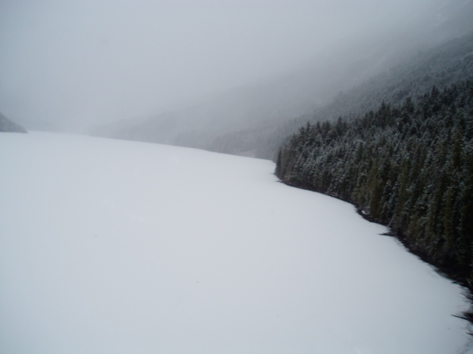
Cheakamus lake on a beauty day!


Cheakamus at nightfall as the temperature drops to -10c


Backside Whistler: (South West)
Khyber overview.kmz (google earth file)
-KHYBER PASS / LEFT OF THE KHYBER-


Coroner arrives at lake after a drowning incident

Sleeping the night in the cakehole
Backside Whistler: (South West)
Khyber overview.kmz (google earth file)
-KHYBER PASS / LEFT OF THE KHYBER-

You will be charged for rescue if mountain resources are used for your rescue. Period....
If your fortunate to have SAR come find you your probably in a really bad situation
Expect a bill in the order of $1000's plus depending on what resources are used.
If you break your leg expect it to be a lot more. Helicopter called in $$$$
Don't go too far left off STU inn, or more than 700 vert ft down slope, or you will be wandering aimlessly through steep gullies, and eventually cliff bands.
You have to clear the khyber pass at this elevation by exiting to the right. The patrol has flagged a low route out (2014) with orange flagging tape follow it to your right. (this route is a little low but will return you back to civilization.) Some side stepping required, or get sucked toward Khyber cliffs, and the Cheakamus Lake area.

If there's not much snow, this area should be avoided.....
Khyber Pass Area

Cliffs if you screw up and go too far skiers left!
Some mountain goats too
Backside: (South side Whistler mountain) (Our most popular)
-CAKE HOLE

Ducking a rope off the back of the Peak chair (south side) will put you in here. This is avalanche country and you should be a well equipped experienced touring party if your going to mess around in here. Avalanche paths start on many of the convex rollovers, and can sweep down into mature forest taking everything with them. The most common mistake is to duck the rope at the top, and ride down the first pitch off MC bowl area.
You should have your avalanche gear in here !!! This area is not controlled in any way by WB.
If you miss the boot pack at the bottom of the first pitch on your snowboard your basically done. Often there is a skin track out right above the big convex roll at the start of the Cakehole proper. Route finding is critical in here the only safe way to sort of to escape is climbers right ridge of the Cake proper or out the boot pack to the skiers right of the main cake. Flagging tape will be added to the Pull it out bootpack in early 2022 to assist exit.
This area avalanches wall to wall in the gulley (see picture below). Once it gets going the walls come in on you like a mousetrap

There's usually a traverse or skin track leading across this gulley just above the convexity. Beware and don't get eaten.......Close to where the boot pack is marked on the map is called pull it out. It usually is put in by locals but not always. You could find yourself wallowing in waist deep powder post hole nightmare....If you go below here there is no easy escape! Cell service quickly ends once in the creek. A couple turns and your sucked in to a very big terrain trap. It becomes increasing harder to escape the beast! This area avalanches wall to wall and will sweep you down into a really nasty creek with trees in it that like to snap people in half!

Click on map to enlarge


Stay away if you don't know what your doing, you may see some tracks only to find other people lost in the cake! Maybe you'll even have friends to spend the night out with. Generally most people will spend the night out as no one knows there down there, and there's no cell service.


Cakehole looking very skinny from the bottom
The waterfall canyon is in the shade in the lower area
Waterfall at the bottom
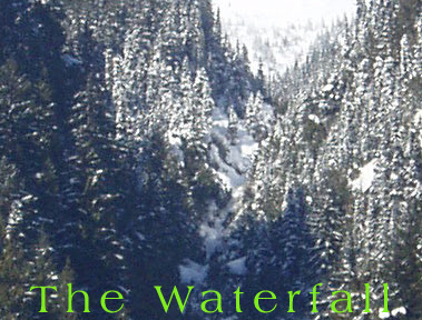
A popular place to spend a night!
BACKSIDE PICCOLO
Waterfall at the bottom
A popular place to spend a night!
BACKSIDE PICCOLO
- If you ski off the back of Symphony chair on the south west side Whistler mtn will put you here. Nice meadows quickly turn into steep terrain flanked by cliffs. Also a huge Avalanche path with big potential for big avalanches. If you make it to the valley look for the Cheakamus lake trail and hang a right. Prepare for a cold night at Cheakamus lake 11km to the road!!! There is a summer trail out but it's hard to follow in winter (marked with reflective markers on trees) Stay out and don't ski off the back of Piccolo.

Avalanche path runs for 3500ft during a good snow year

Picollo lower gulley's

Gullies and Creeks, and more gullies backside Piccolo

Spot the lost guy, look for the tracks first
Piccolo and Flute
North East side:
-BELOW CAT ROAD ON HARMONY OR PICCOLO NORTH SIDE: A trail provides access to Singing pass don't miss the trail (marked with reflective markers on trees) or you will be in the creek which is a tangle of logs and is flanked in places with cliff bands, and gullies. Fitzsimmons creek is a ugly place. The peak to peak gondola now adds some reference for lost people.


WHISTLER BACKCOUNTRY

Whistler's backcountry includes the musical bumps, and is more mellow than Blackcomb offering excellent backcountry skiing.

Whistler's backcountry includes the musical bumps, and is more mellow than Blackcomb offering excellent backcountry skiing.

Stay left of yellow line
EAST SIDE FLUTE/ BACKSIDE- Ducking the rope of the back of Flute is a popular back country area in Garibaldi park. Many ski tourers, split boarders use this area. The usual exit is down the Singing pass trail. Buy a map! Even locals in a whiteout have a tough time navigating it's broad featureless summit area.
The usual entrance to the park is along the ski area boundary sign line about 2/3 of the way along it until you hit the beacon checker, and sign (going left off summit follow rope then cut east towards oboe) If you don't have back country equipment do not use this area! Most people will ski a couple laps back here, and head down the Singing pass trail which leads back to Whistler village.
Singing Pass trail
The backside of Flute towards Cheakamus Lake (going too far right of yellow line!) Will end you up in terrain you will wish you had never entered! Serious avalanche gullies start here and run right to the lake. Even it you make it to the lake you might as well be on the backside of the moon! No cell reception, no people, and probably no tracks, maybe a hungry cougar looking for dinner.
Exit to the right via Cheakamus lake trail (if you can find it!)Don't go east up the lake to what is called moose meadows, putting yourself even further away into the middle of nowhere!!

Backside Piccolo / Cheakamus Lk


Upper Cheakamus river
Moose meadows on not such a nice day!
EAST SIDE FLUTE/ BACKSIDE- Ducking the rope of the back of Flute is a popular back country area in Garibaldi park. Many ski tourers, split boarders use this area. The usual exit is down the Singing pass trail. Buy a map! Even locals in a whiteout have a tough time navigating it's broad featureless summit area.
The usual entrance to the park is along the ski area boundary sign line about 2/3 of the way along it until you hit the beacon checker, and sign (going left off summit follow rope then cut east towards oboe) If you don't have back country equipment do not use this area! Most people will ski a couple laps back here, and head down the Singing pass trail which leads back to Whistler village.
Singing Pass trail
The backside of Flute towards Cheakamus Lake (going too far right of yellow line!) Will end you up in terrain you will wish you had never entered! Serious avalanche gullies start here and run right to the lake. Even it you make it to the lake you might as well be on the backside of the moon! No cell reception, no people, and probably no tracks, maybe a hungry cougar looking for dinner.
Exit to the right via Cheakamus lake trail (if you can find it!)Don't go east up the lake to what is called moose meadows, putting yourself even further away into the middle of nowhere!!
Backside Piccolo / Cheakamus Lk

Upper Cheakamus river
Moose meadows on not such a nice day!
From the heli looking for two lost skiers
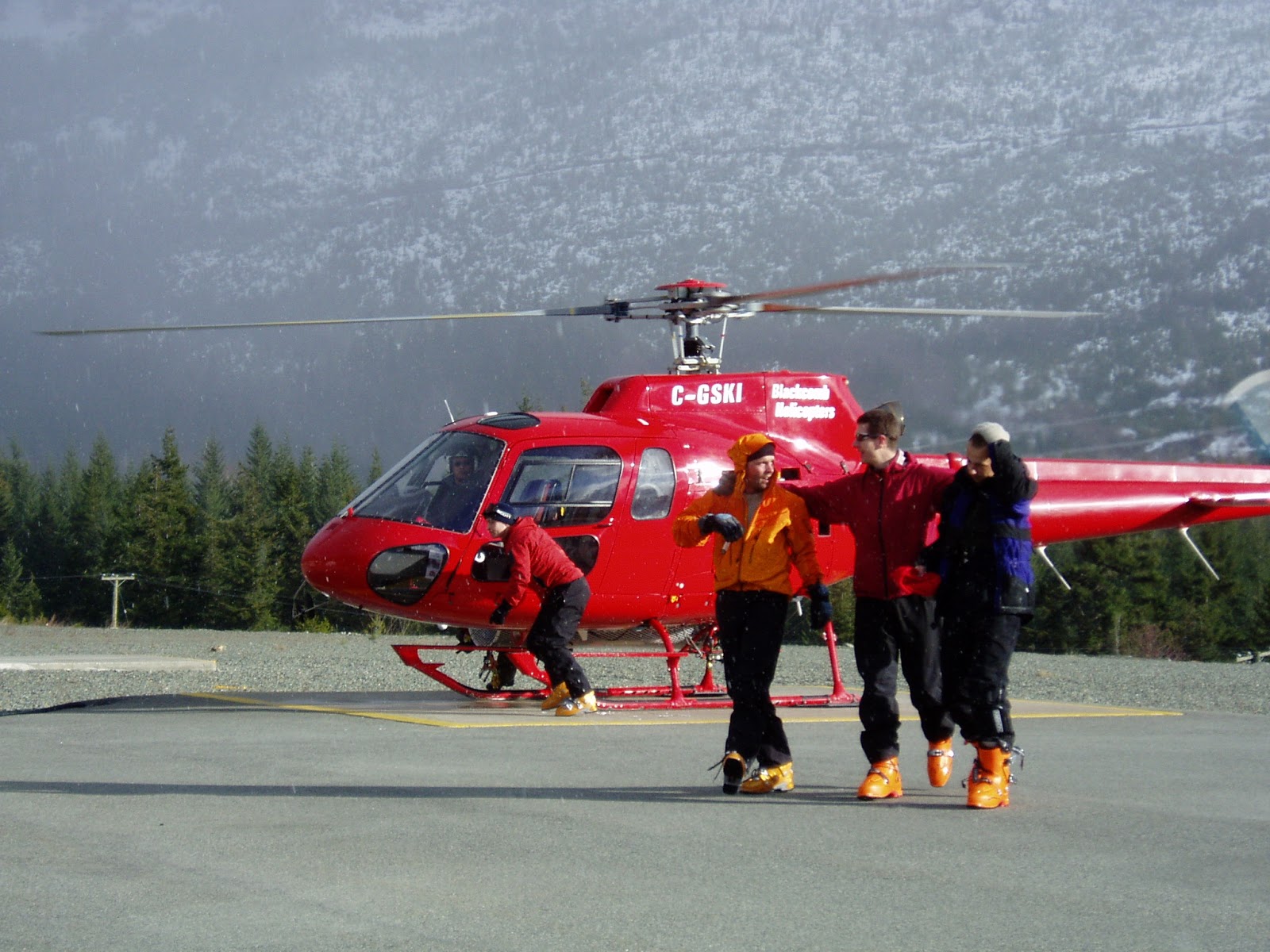
Found!
BLACKCOMB MOUNTAIN:
South side
-BELOW 7TH HEAVEN: A tangle of steep terrain, tight thick trees, and bluffs, if you make it to the valley you are in the middle of Fitzsimmons creek just as it gets dark. 8km away from any Civilization, you might find a snowmobile tour down the valley. The peak to peak now adds some reference fo navigation.

Below 7th Heaven
-BELOW BLACKCOMB GLACIER SKI OUT: A forest that isn't worth anybody's time. Flat tight trees with two canyon like creeks running on either side. Stay out !!
-BELOW BLACKCOMB GLACIER SKI OUT: A forest that isn't worth anybody's time. Flat tight trees with two canyon like creeks running on either side. Stay out !!

Blackcomb and Horstman Creeks
Better for mountain biking than skiing!
BLACKCOMB BACKCOUNRTY

Blackcomb's backcountry is huge! Full of big glaciers/ crevassed areas, cliffs, ice falls, gullies, and big mountain terrain. Blackcomb backcountry is a place to explore once you've mastered your route finding abilities, and snow pack evaluation.

DECKER MEADOWS/ WEDGE CREEK: You can't get here unless you hike!!! Hiking either up towards DOA or Don't swill can put you down here. Usual exit is via the col between Disease ridge and Decker. If your going to Corona or Husume, DOA, Disease ridge, Decker, know where your going. Blindly following tracks will lead you to Whistler Heli ski pick-ups or lost. Only to find the tracks vanish. Don't follow heli-ski tracks.
The other main travel route is via a large bench on the back of Phalanx back towards the poop chutes. If your going into the Blackcomb backcountry buy a map and know how to navigate in white out conditions. A wrong turn will leave you in Wedge creek for a very cold night in a creek! People have died here before from exposure. More recently a young lady spent 3 nights out down here after not telling anyone where she was going! She was very lucky to escape with her life after a helicopter pilot happened to make note of a odd track in the meadows, and reported it after she went missing. Don't be the next one. There is no cell reception, and likely no people down in wedge creek to keep you company. It's 6-8 hours to the road in a good snow pack year, if you know where your going! Buy a good map and you'll be looking at a lifetime of skiing.
Video

Better for mountain biking than skiing!
BLACKCOMB BACKCOUNRTY

Blackcomb's backcountry is huge! Full of big glaciers/ crevassed areas, cliffs, ice falls, gullies, and big mountain terrain. Blackcomb backcountry is a place to explore once you've mastered your route finding abilities, and snow pack evaluation.

DECKER MEADOWS/ WEDGE CREEK: You can't get here unless you hike!!! Hiking either up towards DOA or Don't swill can put you down here. Usual exit is via the col between Disease ridge and Decker. If your going to Corona or Husume, DOA, Disease ridge, Decker, know where your going. Blindly following tracks will lead you to Whistler Heli ski pick-ups or lost. Only to find the tracks vanish. Don't follow heli-ski tracks.
The other main travel route is via a large bench on the back of Phalanx back towards the poop chutes. If your going into the Blackcomb backcountry buy a map and know how to navigate in white out conditions. A wrong turn will leave you in Wedge creek for a very cold night in a creek! People have died here before from exposure. More recently a young lady spent 3 nights out down here after not telling anyone where she was going! She was very lucky to escape with her life after a helicopter pilot happened to make note of a odd track in the meadows, and reported it after she went missing. Don't be the next one. There is no cell reception, and likely no people down in wedge creek to keep you company. It's 6-8 hours to the road in a good snow pack year, if you know where your going! Buy a good map and you'll be looking at a lifetime of skiing.
Make a wrong turn into wedge creek, and this could be you! Just ask Julie.
Missing snowboarder in wedge creekVideo
 |
| Decker meadows leads to Wedge creek, don't go down there! |


Think again this area is regularly swept by big avalanches and cornice fall from above

Don't Swill in fairly good conditions
RESPECT ALL AVALANCHE CLOSURES AND PERMANENTLY CLOSED AREAS!!!!!
Duck a rope and be prepared to get yourself into a mess of trouble. Patrol will be pulling passes of individuals not respecting these closures. (your pass could be gone for a year including summer). Consider that there may be a fire in the hole (bomb above your head). Then patrol will have to stop what they're doing, and deal with you! Thus stopping their avalanche control route which then delays opening the rest of the mountain. Poaching these boundaries not only puts yourself at risk, but others who will follow your tracks.

Area's are closed for a good reason..... People routinely die here!


Enter only through gate
Travel with competent companions, and be prepared for self rescue.
RESCUE MAY NOT BE POSSIBLE!!

Hey Sam

If you require assistance dial 911..
Last updated : BCD December 2021